The University of Otago is a major party school, and the first week back from summer “O Week” is one of the biggest party times. My flat on Castle St. is in the middle of the action, meaning that it is easy to meet new people and a short walk to class, but it tends to stay loud late into the night. My flat consists of Timothy (Hong Kong), Claire (Chicago), Anni (Massachusetts), and our kiwi host Danni (New Plymouth, NZ). Something that I hadn’t realized before coming here is that over 50% of international students at Otago are American.
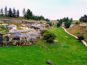
O Week lasts a full week, but I only enjoyed two nights of it before heading out to Maerewhenua River with my geology mapping paper. In New Zealand “paper” is the word for course. The week-long trip had spectacular views, was a great way to make friends, and I learned valuable mapping skills. Cyclone Gita delivered heavy rain the first two days, making note-taking difficult and camp life absolutely miserable. By the second day every river in the region was flooding, so our instructors cancelled the scheduled visit to a river outcrop, instead taking us to the Valley of the Whales. This limestone outcrop, in the middle of a sheep pasture, is the richest marine fossil record of the Oligocene Age, about 23-33 million years ago. Half excavated and protected by an outdoor display case are early whale bones; the surrounding cliffs are full of other ancient shells.
Valley of the Whales
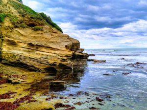
The weather cleared up for the remainder of the week, giving us a chance to visit an outcrop below Benmore Dam, a giant hydroelectric dam. In New Zealand about 85% of electricity is generated by renewable energy, dominated by hydro and geothermal. Here we learned to use a stereonet and draw a stratigraphy log. The following day we visited the coast near Oamaru and were evaluated on out strat log of a great sandstone cliff. Nearby was a silky seal lounging in the sun, lazily watching us work.
Seal on sandstone cliffs near Oamaru
Near the end of our trip, we spent a day practicing triangulation near a lime quarry in Tokarahi region (incidentally Tokarahi translates as “many rocks”) . The Tokarahi Lime Quarry is on the top of a limestone plateau and, separated by small farming valleys, similar plateaus were visible all across the region. While breaking apart chunks of discarded limestone I found a perfectly intact shark tooth.
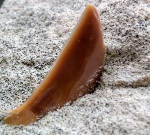
A 3cm shark tooth, about 25 million years old.
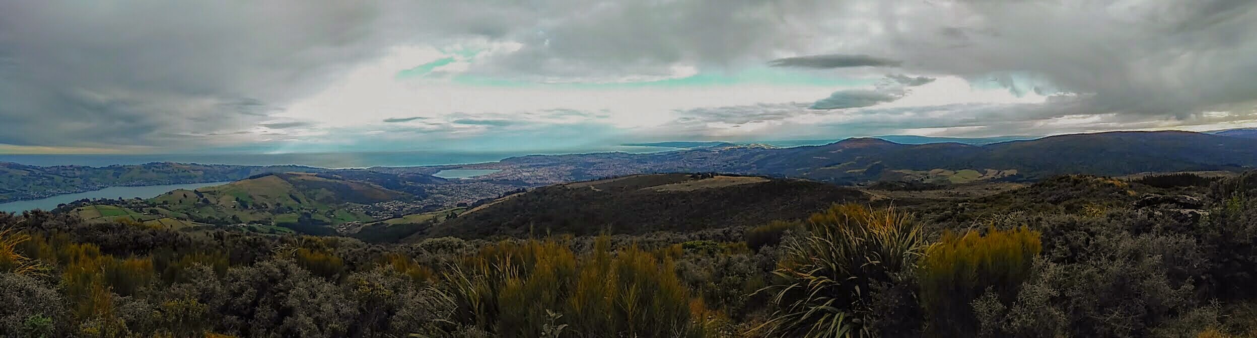
The final day of our field paper was on the pasture lands of Tokarahi. Our final assessment for the trip was to map a basalt layer across an area 2km long, and this was done largely by walking along the top of a cliff, plotting the location and elevation of the layer. Views of the surrounding country were excellent from up high, and the peaks of the southern alps were just visible above the rolling countryside.

Pasture at Tokarahi
The Maerewhenua Geology Camp has introduced me to the beautiful landscape of NZ and helped me to immediately make friends. This week I’ll be starting my other papers, and diving into the bustle of Dunedin life.